
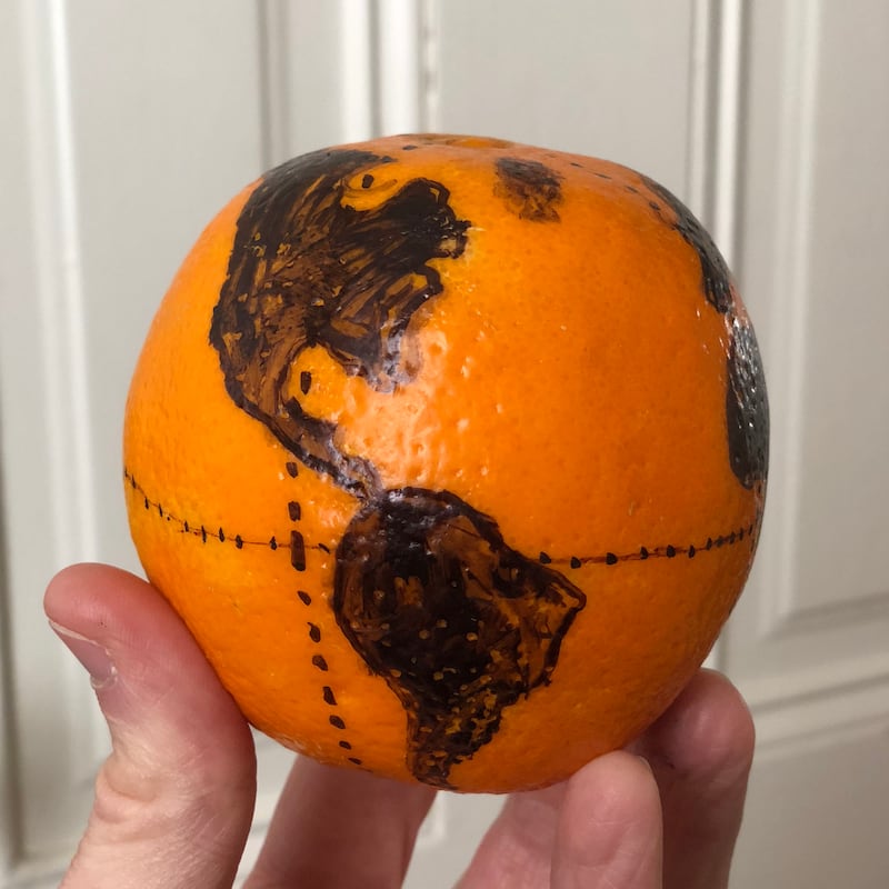
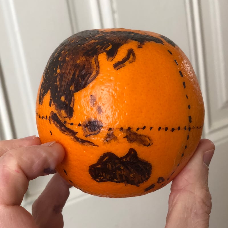
Here’s a map of the world recreated on an orange.
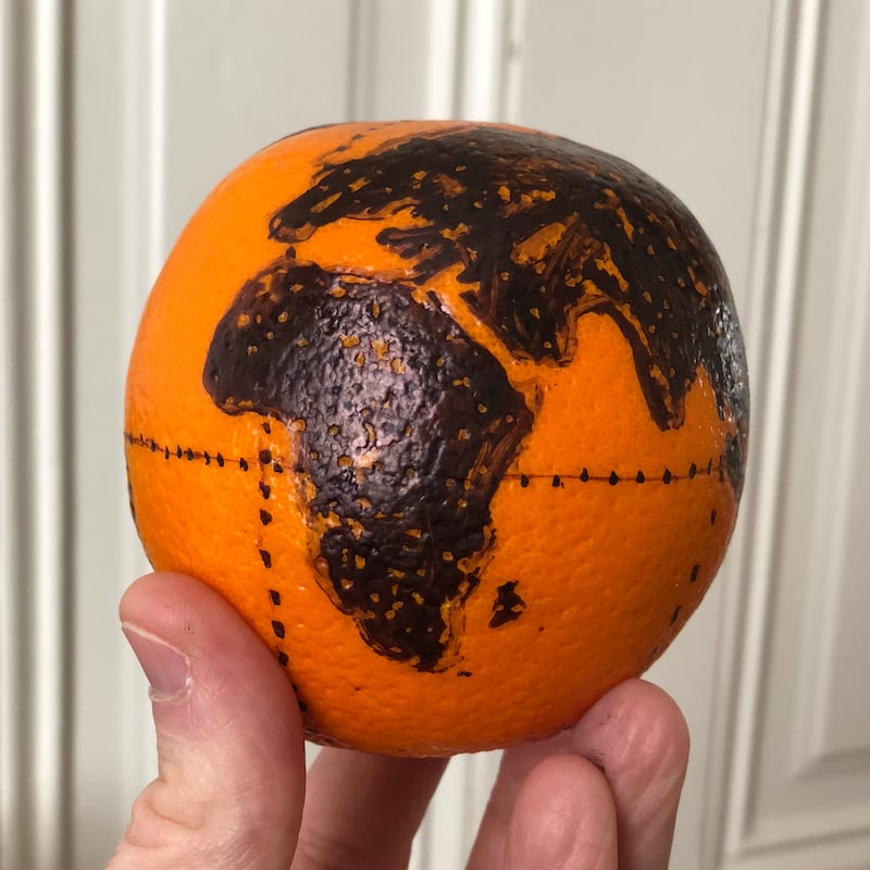
And it’s more than just an exercise in whimsy – it was created by RJ Andrews, a data storyteller from San Francisco, to demonstrate a key problem in map making.
By necessity, maps of the globe become warped when flattened out – for example, to be contained in the pages of a book.
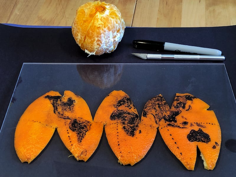
To hammer this message home people often draw on an analogy of being unable to peel an orange without tearing it somewhere.


The morning he created his orange globe, he had been reading a book by Alberto Cairo which discussed this and brought up the orange metaphor.
Andrews told the Press Association: “I believe play is an important part of work, and especially any creative process, so I try to let myself get distracted by fun little side quests like acting out what everyone just talks abstractly about.
“Making the imaginary real can be powerful, and often very fun.”
The result is a series of pictures which show how he created his orange globe, reduced it to a map and perfectly demonstrated the distortion issues.
He nailed it on the first attempt with a 12-inch globe in front of him as a reference.
“I drew the equator and prime meridian as reference points. Then, dotted a couple dozen major land features before finally connecting the dots to make the shorelines.
“The waxy surface of the orange was not agreeable to the Sharpie permanent marker. It took a few markers to finish.”
Once the lesson was over, Andrews ate the fruits of his labour.
“It was juicy, sweet, delicious!”
He shared the pictures on Twitter back in February, where they have steadily garnered interest with likes and retweets.
I got tired of just reading about this pic.twitter.com/Ucn8OzCjel
— RJ Andrews (@infowetrust) February 23, 2018
Here’s an HD scan of the peel & some before 🔪 shots. My apologies to 🇦🇶🇨🇺🇮🇸 Tasmania etc
p.s. was delicious pic.twitter.com/OgCXHjfKNL
— RJ Andrews (@infowetrust) February 26, 2018


