GIVEN the amount of water seeping out of the ground on the slopes of Slieve Croob this week, the River Lagan should be a surging torrent as it flows through Belfast. The river which defines the city has its origins on this wind battered mountain in Co Down, emerging from the ground as a small stream and gathering strength as it twists its way towards Belfast Lough.
Slieve Croob and the Dromara Mountains are stumps of hills when compared to their near neighbours the Mournes, but the Mournes are mere babies in comparison when it comes to age, having emerged around 60 million years ago, six million years after the dinosaurs became extinct. The Dromara Mountains first emerged from the ground around 360 million years ago, 100 million years before dinosaurs had even evolved.
Time has taken its toll and what would once have been a massive mountain range has been eroded and crushed by glaciers to its more diminutive presence today. At just over 500 metres tall, Slieve Croob is one of easiest mountains in Ireland to climb, not least because of the tarmacked road that ambles to just below the summit. However, the unappealing name Transmitter Road contains an ominous warning for what awaits you when you get to the summit.
Four separate telecoms transmitters surrounded by impenetrable fences topped by barbed wire have been built on top of Slieve Croob, each of them towering higher than a Tyrannosaurus Rex. They are an eyesore, but unbelievably fade into the background when, if it is a clear day, you start to take in the surrounding countryside. To the north lies Belfast, the distinctive orange cladding on the City Hospital and the other high rise buildings clearly visible. Behind the city lies Divis Mountain and beyond Belfast Lough the Antrim hills.


Turning inland towards the west you can see Lough Neagh, a sliver of water on the horizon. Further south Slieve Gullion in south Armagh, the Cooley Mountains in Louth and southern slopes of the Mournes merge into a single landscape. The higher slopes of the Mournes are much closer and from this height you get a sense of their layout and how they rise and fall away, unfolding and rippling before cascading into the Irish Sea. Newcastle is clearly visible, Murlough Bay, Dundrum and to the east the drumlins of Lecale, cut from the Ards Peninsula by Strangford Lough.
At the summit of Sliever Croob is a small cairn – the mountain it is known as the Twelve Cairns – while its official name comes from the Irish Sliabh Crúb, ‘the mountain of the hoof’. The lower slopes are also worth exploring, with an impressive network of footpaths and not-too-busy roads allowing good access to the surrounding countryside.
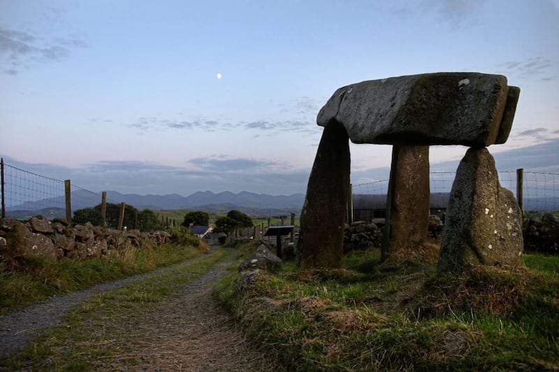
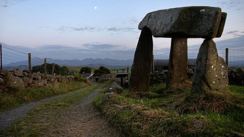
Unmissable is Legananny Dolmen, a quite small but superbly evocative structure which has stood against a stunning backdrop of the Mournes for around 4,000 years. Also a short walk away is Finnis Souterrain, which probably dates to the early Christian period – an underground series of passages, which would have been used to hide people and goods from marauding invaders. Unfortunately it was waterlogged when I crawled in on Tuesday, but it’s there for another day.
Finally, after a morning of being battered by the wind on the summit of a mountain, pondering on the engineering skills of Neolithic man and crawling down a flooded ancient passageway, I needed some nourishment. If you’re in this countryside between Dromara and Castlewellan, the superbly named Turnip House offers the best vegetable soup you could have, setting you up for another few hours of climbing and clambering.