New satellite images have revealed how volcano Anak Krakatau has transformed the shape of Indonesia’s Sunda Strait island after an eruption triggered a deadly tsunami.
The shots, taken by Planet Labs’s Dove and SkySat satellites, provide the clearest glimpse yet of how the volcano’s collapse has impacted the island.
They show a large empty dip where Anak Krakatau once stood at 1,115ft.
It is thought that the crater peak is now only 361ft.

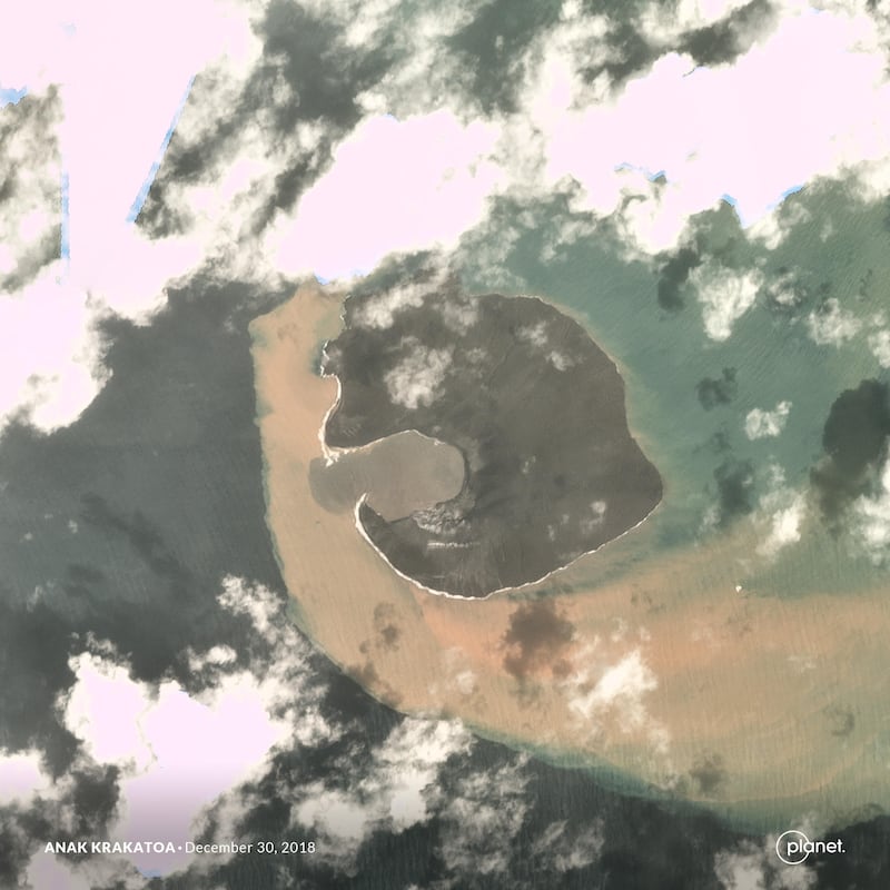
Cloudy weather and explosive volcanic activity made it tricky for satellites to capture the full extent of the eruption and the devastating events that followed.
Until now, experts were largely reliant on satellite radar images instead of a clear optical view.
Planet’s images show the island before the eruption on December 17, alongside images captured on December 30 and January 2.
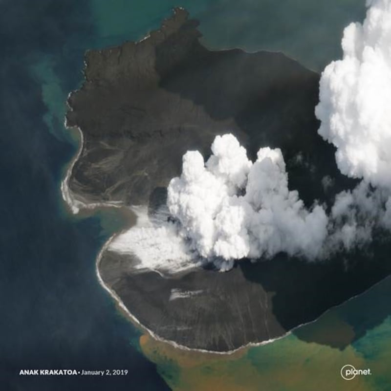
Much of the volcano is thought to have slipped into the sea, with the landslip causing a tsunami on December 22.
It left at least 430 people dead and displacing thousands.
Scientists believe Anak Krakatau is now only a quarter of its original size.