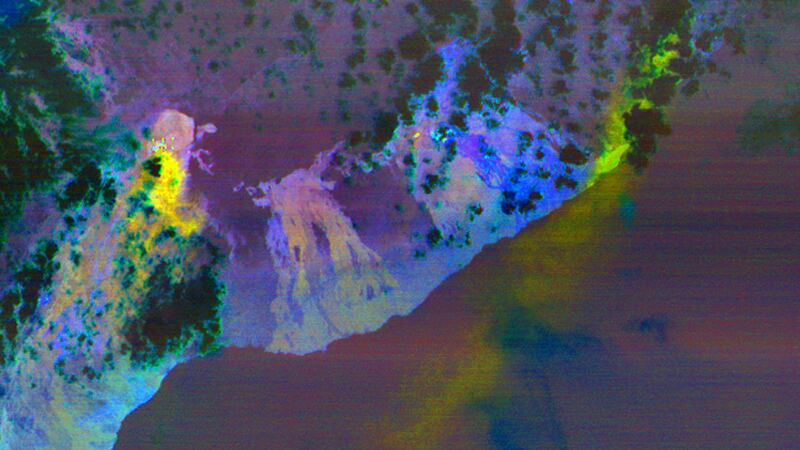
Photos taken by a Nasa satellite reveal a bird’s-eye view of the continuing eruption at Kilauea volcano in Hawaii which destroyed dozens of homes and forced around 2,000 residents to flee.
The two false-colour images, taken by the US space agency’s Terra research satellite, show fissures along the volcano’s East Rift Zone leaking lava and emitting plumes of the toxic gas sulphur dioxide.
The red areas show the vegetation, the black and grey areas are old lava flows, while the yellow areas superimposed over the image show the hotspots, which are newly formed fissures and lava flows.
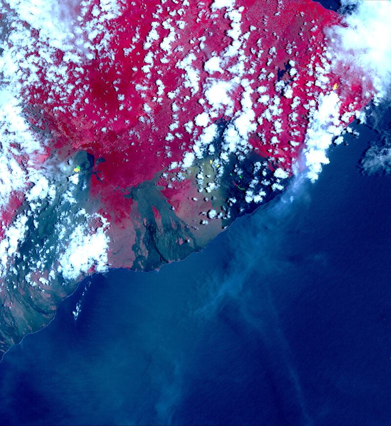
Long plumes of sulphur dioxide, a colourless, foul-smelling toxic gas that can cause inflammation and irritation of the respiratory system, show up as yellow and green streaks.


Located on the southeastern side of Hawaii’s Big Island, Kilauea is considered one of the world’s most active volcanoes.
Its crater began to collapse on April 30, which was followed by earthquakes, including one that measured magnitude 6.9.
The recent eruption of Hawaii's Kilauea Volcano triggered a number of gas and lava-oozing fissures in the East Riff Zone of the volcano, seen by @NASAEarth satellites in space. Here, sulfur dioxide plumes from the new fissures are shown in yellow & green: https://t.co/XrNhVonmEW pic.twitter.com/aO5M3GrYBV
— NASA (@NASA) May 8, 2018
Lava has spread more than 387,500 square feet (36,000 square metres) from the most active fissure, with its movement slow but relentless.
Experts are unsure when it will stop, with US Geological Survey volcanologist Wendy Stovall saying: “There’s more magma in the system to be erupted.”
The Terra satellite, which orbits 438 miles (705km) above the planet’s surface, was launched in 1999.
In addition to keeping an eye on volcanic activity, Terra carries a payload of five remote sensors that monitor the Earth’s environment and ongoing changes in its climate system.