The instantly recognisable lines of Harry Beck’s London Underground map have inspired a series of subway maps for cities around the world.
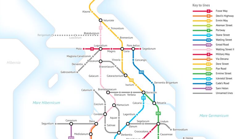
And now, Beck’s modern mapping of London has been fused with the geography of Roman Britain to produce a tube-like network of Britain’s Roman roads.
University of Chicago Student Sasha Trubetskoy set about creating the map of major routes, modelled on the Empire of circa 125 AD.
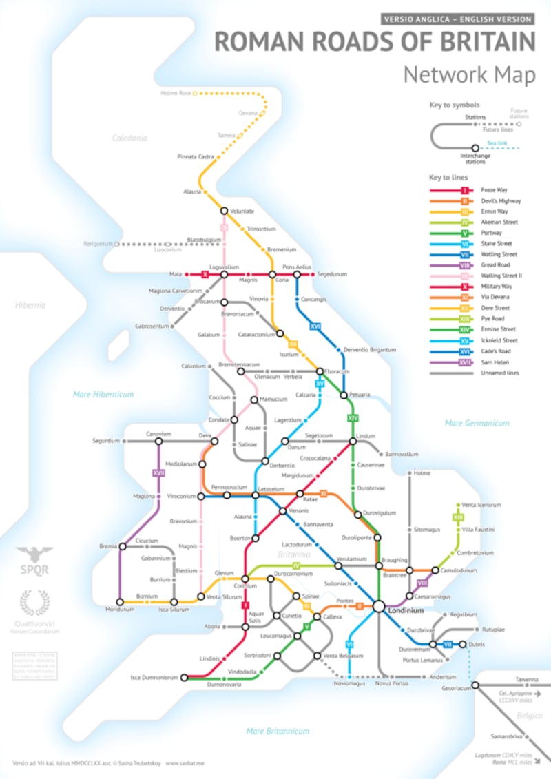
The impressive visualisation, which provides a fascinating look into Britain’s identity under the Roman empire, links major towns and cities – identified by their Latinised names.


Much like the Tube map, Trubetskoy has taken some creative liberties and simplified the shape of the routes, to highlight their connections as opposed to exact geographical locations.
But the map, which took around 20 hours to complete, required vast amounts of research from the young cartographer and self-proclaimed “geography nerd”, who spontaneously created it in his free time.
Work In Progress: lots of you demanded a tube-style map of Britain's Roman roads only. Ask, and it shall be given you pic.twitter.com/EFVMPeAqTl
— Sasha Trubetskoy (@MyBoyTrubetskoy) June 28, 2017
“I’ve always been fascinated by Ancient Rome and I figured their road network would be perfect for this kind of medium, so I went for it,” Trubetskoy told the Press Association.
“I’d seen a lot of poorly made tube-style maps on the internet, and I wanted to do better.”
He added: “I worked intermittently in my free time, so it’s hard to track hours. It took me a few weeks of on-and-off work, probably around 20 hours total.
Trubetskoy has previously mapped out the network of major roads of the Roman Empire, which span much of modern-day Europe, north Africa and the Middle East, in the same tube-style format.
Around 2,000 miles of road made up the paved network in Britain, which was built to accommodate travelling troops and military supplies, as well as accelerate trade.
Some of the roads, which were constructed over four centuries between 43 AD and the Romans’ withdrawal in 410 AD, are still in use, while others were lost to history.
None of the original road names survived past Roman rule in Britain, as there were no written records, as Trubetskoy, a statistics student, explained on his website.
“Watling Street and Ermin Way are not exactly Latin-sounding. Roman Britain was not as well documented as Italy or Spain, so there is a huge lack of written sources.
“That’s why the names that we do have are actually Anglo-Saxon, and originated a few centuries after the Romans had left,” he said.