EVEN in among the traffic, bricks and mortar of Belfast city centre you never have to move too far to see the mountains calling you into their wilderness. The peaks of Divis and Black Mountain seem to lurk at the end of streets or between the rooftops of offices, shops, hotel tower blocks and public buildings.
The steep slopes form a natural barrier against further encroachment, stopping the city's suburban sprawls from spreading any further west.
A 20-minute drive from the city centre – in non-peak-time traffic – takes you to the car park on Divis Road. It is busy with loners and small groups setting out for a Monday morning walk, but they soon disperse and the path becomes less crowded.
A paved track to the right – the Ridge Trail – leads over bogland and past an occasional gnarled tree, stripped of leaves by the high winds of recent weeks. Even on this mild October morning the wind has a sharp tug to it as it comes in over the high, open ground.

Dark, boggy water gathers in pools and an occasional murky stream cuts through the heathland. The National Trust has done a superb job on paving routes with stone and wooden slats over ground that would otherwise entail a lot of squelching.
The Ridge Trail curves away from Divis Mountain, the highest peak in this small range and, as the name suggests, along a ridge overlooking the city below.
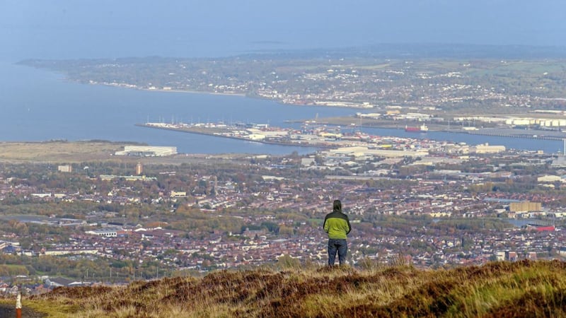
The Harland & Wolff cranes are the first thing that jump out at you and then with a bit of perusal other familiar landmarks reveal themselves – the green dome of Belfast City Hall, Divis Flats, Windsor Park and across the motorway and to the south of the soccer ground, Casement Park in all its abandonment.
The Balls on the Falls, where the M1 becomes the Westlink, is a good location marker and allows me to identify green swathes of land among the built-up areas as the Bog Meadows and Milltown Cemetery. In fact it is surprising how much open space there is in Belfast, oases of green in among the gridded streets of houses and shopping developments. Also clearly visible are the 'peace walls' on the Springfield Road and between the Falls and Shankill.
The sun is low and so the Mourne Mountains to the south are just an abstract outline on the horizon. Clearer is Scrabo Tower in north Down and perched crookedly on a hillside sits Stormont, arrogant and impotent.
Belfast Lough opens out into the Irish Sea and on the opposite shore, up into Antrim, the not-so-pretty chimneys of Kilroot power station. In fact eyesores are an issue here with huge TV transmitters and phone masts utilising this elevated position to ensure maximum coverage – but in a way their ugliness accentuates the stark and raw beauty of the boggy landscape.
The Ridge Trail, which runs for just over four miles, rises to the summit of Black Mountain, before curving back inland and along the lower slopes of Divis, which is a tight but short hike upwards.
Other trails are the Heath Trail, which also runs for around four miles, inland and to the north of Divis, while the short – just under a mile – Lough Trail has views over to Lough Neagh.
Belfast Hills Walking Dynamos are organising a torchlit walk up Divis on November 15, setting off from Divis Car Park at 7pm. Cost of walk is £1 for group members and £6 for non-members but if you are a non-member and want to join in, mention The Irish News Take on Nature when booking a place and you will be charged £1. Visit https://bit.ly/2PcCy4n for more information and to book a place.


